Blog Exercise Nine

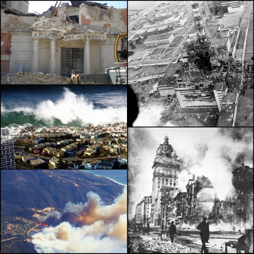
Hazards and Risks area all around us no matter where we go they will always be there, but there are ways that we can understand and mitigate with respect to Mother Nature. First off a hazard is based on past events and the risks are based upon probability for the future. Some of these hazards are shown in the images above. One is a tsunami, which is caused by a displacement of water. This could be from an earthquake, volcanic activity, or arbitrary mass wasting. Tsunamis are measured by two lengths, run-up and wave height. Run up is the elevation on land that the water is pushed up on. Wave height is the height at which the largest wave got up to. To mitigate tsunamis, at least in the Pacific Ocean there are buoys and if one shows displacement a signal goes off to warn people that a possible tsunami is on the way. There is technology now that can predict, if the signal is triggered, the times and places the tsunami will hit, giving people enough time to react to the situation. Another hazard is earthquakes that are shown in the images above. Earthquakes have two different scales that they are measured by, the Mercali and the Richter scales. On the Richter scale, it usually just goes up to a magnitude of 8 but can reach 9.0 if needed. The Mercali was Italian and has 12 steps of devastation that is calculated by damage done from the earthquake. Earthquakes happen along slip faults, subduction zones, continental collisions, and dormant plate boundaries. The largest one in U.S. history was in Numadrid, Missouri but little damage was done, this was along the Madrid fault line. One of the most devastating was the one in 1906 in San Francisco, California. It happened at 5:12 A.M. on April 18th, 1906 with a magnitude of 7.7 the epicenter was two miles away from the city. Not only was the earthquake devastating but it sparked a horrific fire that tore through the city. The fire was started by a gas line that had broken, when a lady turned on the stove the morning after a fire bomb exploded burning most of the city. There is no way to predict the onset of a earthquake except for looking at past events and making a probability time line unto which it will occur. The only way is to educate people on what to do when one is happening and what to do afterwards. There is also a way of implementing building codes to help with the structures withstanding that of an earthquake. Building codes are also a way to mitigate another hazard, which are hurricanes. Hurricanes are huge storm systems that develop over warm bodies of water and hit land. Normally, the most impacted lands are the ones hit by the northeastern quadrant. Hurricanes nowadays can be seen before they hit by radar, which can inform people when they need to leave for safety precautions. Volcano eruptions are another hazard to people. There is no such thing as a true dormant volcano. Multiple problems can be seen with volcano eruptions: pyroclastic flows, gases, ash, lahars, lava, and debris. Lahars are the snowmelt that runs off and floods canal systems with muddy water. Pyroclastic flows are fast flowing burning ash and gases that are extremely fast acting and there is no out running one. There have been strides in warning people of an eruption but there is still nothing to say the exact time when an eruption will occur. These are some of the hazards that poses a threat to cities all around the world.

All the bairns o' Adam

Blog Exercise Nine

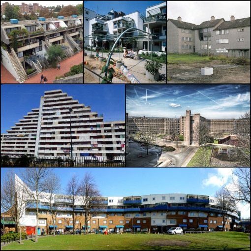
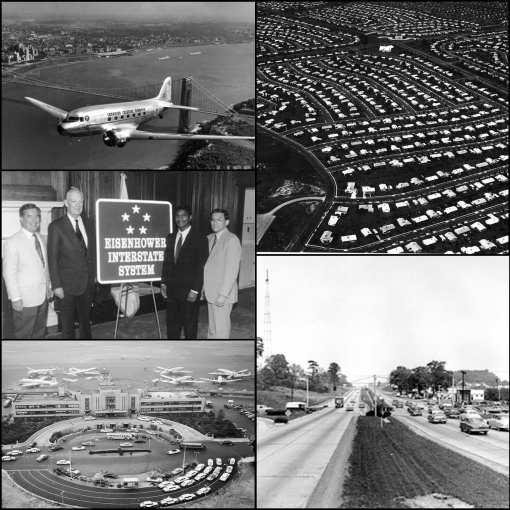
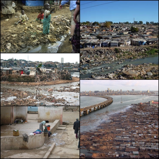
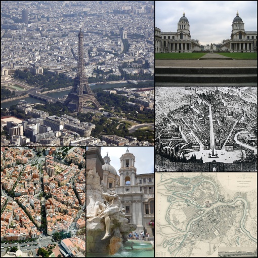
The usual rules…don’t attempt to identify the particular disaster, just talk about hazard and risk in each of these instances…

View original post

Blog Exercise Eight….

Above are photographs of examples of the urban sprawl or also known as suburban sprawl post World War 2. Urban Sprawl is defined as the spreading of a city and its suburbs over rural land at the fringe of an urban area. The people that reside in these areas tend to live in a single-family home and commute by automobile to work or to run errands elsewhere. This wide spread of moving to housing from within the inner city borders to the countryside started happening in the 1950’s and 1960’s. This was after World War 2 when the GI Bill was implemented and the road building projects were put into place. The so called “suburbia” life was publicized as a better quality of life. Along with the governments help with subsidies and cheap land to buy for housing, urban sprawl went through the population like fire. As it spread though, there was very small amount of control over the planning of these suburban areas. These vastly growing suburban areas are generally a low densely populated development that consists of strip malls and large office buildings, and housing subdivisions, which are all connected by roads. The subdivisions are usually priced within a specific price range. With this wide spread of people, you have a smaller amount of people that own a larger part of land. As the people and housing spreads out so do the buildings and roads. Little did we know, all these factors put together would have a tremendous impact on our environment around us, which we now are seeing signs of in this day. We now see that the urban sprawl has had a detrimental effect on the ecological systems and their functions in nature. Some examples that we can look at are the wildlife habitats and wetlands. The suburban areas what are connected to the commercial developments have now resulted in habitat fragmentation, where it forces the animals that once lived within that area to migrate elsewhere. Also it is changing the migration patterns of certain animals and blocking feeding areas. Not to mention that in urban sprawl areas there is not much in the way of public transportation, so in turn most families own at least one vehicle. This in fluctuates the carbon emissions along with other effects that cars bring into the environment such as air and noise pollutants. With these buildings, huge parking lots and streets, our water supply has been endangered of getting contamination with the new pollutants being synced with the water supply by ways of runoff. For the most part the government is still promoting sprawl, but now very recent there has been efforts to start building “up” in what cities have emerged from this sprawl or urbanization. They are trying to have more restrictive development and zoning policies put into action as well as including tax incentives. Also an effort in making public transportation more affordable and accessible is starting to become more prominent. Urban sprawl is something that is somewhat of a double edged sword, it has its good points but also it is having a huge impact on our environment around us.

http://enviroliteracy.org/article.php/409.html
http://wd.northwestern.edu/assets/Watersheds-7-Urban-Sprawl-article-questions.pdf

All the bairns o' Adam

Blog Exercise Eight....

You know the drill…500 words…

View original post

Blog Exercise Seven

In our world today cities around the globe are becoming more and more alike in becoming what is now known as homogenous cities. They are all sharing the same properties as far as the way their cities are being globally advertised and have central business districts. These central business districts foundations include corporations, architecture and components that are not considered “local.” It is not unlikely to be able to build a skyscraper that looks as if you were in New York City in Shanghai or have a building in Rome resemble that of Moscow. Globalized advertising also has to do with this worldwide spread of westernization. Having similar looking cities means that in some way the city is going to have to be able to “stand out” in its own special way and draw tourist to their city, which can be done in a couple different ways. One of the ways cities are doing this is by building “icons” within their city. For instance, in the above pictures are examples of many different “icons” that cities have built up to attract people and to make their city stand out in their own special way. One of the pictures shows the golden gate bridge of San Francisco, being declared one if the Wonders of the Modern World having the longest suspension bridge main span in the world. Another is the Sydney Opera House in Sydney Australia. This building is a very uniquely built structure that was constructed by a Danish architect names Jorn Utzon. It is considered one of the best performing arts center in the world. Another iconic building is the Shard Tower that towers over the London skyline. It is currently one of the tallest buildings in the United Kingdom and with it made of glass reflecting the natural light is a wonder to see. One other stunning skyline is that of Hong Kong China, pictured above. It is known for how the use of colored lights at night being reflected on the water that the city sits beside. Rio is another prime example of iconic features because it uses a manmade monument as well as their surroundings. Rio uses not only a human built icon but also the landscape surrounding the area of the city as well to stand out in the worldly crowd. With beautiful beaches and surrounding mountain scape scenery, one cannot forget Christ the Redeemer looking over the town atop the mountain Corcovado. In addition to these pictures these are only a few among a plethora of different “icons” that make each city stand out in its own special way. There are many landscapes that are used to draw attention to their cities. For instance, Denver Colorado has Red Rock, one of the most iconic venues in the United States for concerts. Rome has plenty of historical architectural icons such as the Pantheon. One sign that everybody seems to know and have heard of that has no use to anyone what so ever is the Hollywood sign in California. Even though cities are becoming homogeneous in ways of having access to looking very similar, there will always be something that sticks out to tell a story about that particular city. Whether it be from the surrounding landscape to a huge magnificent building, to just a simple sign, cities around the world may become more alike but there will always be a way that their heritage of a piece of the city stays within their culture and makes the city different from the rest.

All the bairns o' Adam

Blog Exercise Seven

Hey there, usual rules, but wait until after Thursday’s lecture to try to respond to this one…I will get the last couple graded by the end of this week…

View original post

Blog Exercise Six

Here we are looking at social housing in Europe. Social housing is a type of public housing or affordable housing. Social housing key function is to provide accommodations that are affordable to people with low incomes. This in turn lowers the amount of rent owed by each tenant a month that is usually regulated by laws that are enforced. In Europe affordable housing is largely managed by nonprofit housing associations with very few private builders are involved. It does differ from country to country but mostly there social housing program is much more effective than the one we have here in the United States. Developers in the Netherlands and U.K. for example always have direct access to a large amount of financial resources. In the Netherlands there is a loan guarantee program that is funded by builders that allows them to borrow money from banks at extremely low rates, along with this there is a minimal amount of paperwork. The other reason is that both of these countries have vast amount of size and strength. Some housing developers own anywhere between 50,000 to 70,000 units, while others that are considered ‘smaller’ control around 20,000 units. An example of this great system is in a city called Tillburg in the Netherlands, which is the nation’s seventh largest city. Fifty one percent of the population is social housing. One more of the popular cities would be London, where an average of thirty percent of the population live in government housing. Another positive point is that there isn’t just a neighborhood of social housing. The units are mixed in all together not creating a line of on the market houses and social housing. Therefore it all blends together and the houses that are social housing look as if they were to be put on the market. A program that has come into place to contribute to the U.K.s housing system that is informative, rigorous, and reliable is BSHF. They make their research available to politicians and policy-makers, as well as to housing practitioners and other researchers. In 2009 they published a comprehensive review called The Future of Housing. It highlighted the eight key areas that need attention. These included house price volatility and increasing the range of housing providers in order to combat undersupply and increase the quality and variety of housing. (BSHF)Europe does a great job at putting the needs of housing first to everyone, no matter what social class or where you come from. There are problems that come along the way but the importance of everyone to have a roof over their head seems to always make the negative aspects disappear.

Works Cited
http://www.bshf.org/ukhpp/?lang=00
http://www.shelterforce.com/online/issues/133/europe.html

All the bairns o' Adam

Blog Exercise Six

These are all images of social housing projects in Europe…discuss (both the images and the history, execution and success of such projects)…

View original post

Blog Exercise Five

Seeing America pre and post World War II is like looking at two totally different countries. Although pre World War II America is still developing in numerous ways but compared to after World War II it seems to be at a turtles pace. There are very important inventions that come into place such as, the telephone and automobile. Another feat before this era is the railroad system that is put in place all this with the industrial revolution being taken place. As far as the economy goes, it was suffering and barely there and when the Great Depression hit it was a severe spiral downhill. Needless to say World War II which was the main reason we got out of the Great Depression, helped jumpstart our economy as well as the growth of our country as well in all aspects. The winning of World War II gave people the confidence and optimism in themselves that they needed. One of the major events that took place was the event of “urban sprawl” or the spread of the suburban areas around the United States. The Federal Housing Administration was made into effect as a part of the National Housing Act in 1935. In a 1936 Bulletin the FHA took concepts from three people, Unwin, Perry, and Stein, and put them all together to come up with a concept of planning a neighborhood. Three forms were then laid out for a framework of residential street layouts; Curvilinear, Cul-de-sacs, and Courts. By 1959 this administration had helped three out of every five American families purchase a home and helped millions of families to repair their damaged homes. The FHA did not only help homeowners but banks, business establishments, farms, and building and loan associations. Another helpful attribute was The G.I. Bill of Rights that passed in 1945, helped veterans get money to go to school along with being able to afford and own homes. This helped the veterans want to further themselves after getting back from war and along with this start a family. In turn here comes the baby boom and population started to rise. With the added population and people buying houses, the economy started going up again with the necessity of needing/wanting to buy more goods for the house.
One other very important invention post World War II was the jet engine, by Frank Whittle in 1928 but not technically used until 1941 when the air forces started using them. The first U.S. jet was the Bell P-59A Airacomet. Mostly jets were used in the war or commercial use but then followed for public use as well as delivering mail and cargo. This in turn became huge airports which created more job opportunities that put more people being able to contribute to the economy.
Finally one of the most influential attributes to America that is pictured above is the Eisenhower Interstate Highway System. On June 29th, 1956 President Dwight Eisenhower signed the Federal-Aid Highway Act. This bill pertained to the elimination of unsafe roads, insufficient routes and all things that encompasses all troubles on roadways. This included a 41,000 mile of national systems of interstate and defense highways that linked a little over 90 percent of all cities with populations over 50,000. The cost of this act was distributed over a span of thirteen years that totaled a whopping twenty five billion dollars.
With these aspects that furthered the American economy after World War II, we start to see an America that is unafraid and striving for improvement. The optimism and confidence that was found among Americans just kept getting stronger throughout the years post World War II. We see this by the wills in the people of America. People who are fighting for their rights as individuals, fighting to stay a “free” country. From African Americans fighting so bravely for their rights to equality to the all the women who stood up for what they believed to fight gender standards. As far as a community of people we have come a long way since before the Great Depression and these are some of the things that influenced these happenings.

All the bairns o' Adam

Blog Exercise Five

Usual rules; reblog, 500 word commentary, remember to actually reference the images in your response…

View original post

Blog Exercise Four

The images above depict a very disturbing image of what people call everyday life living in the slums of Africa. A slum is defined as a district of a city marked by poverty and inferior living conditions. The slums have characteristics such as: lack of a secure tenure, poor access to water, lack of sanitation facilities, insufficient living areas, and poor structure and durability of housing. (Homeless-international) Also with the poor housing too many people living under one “roof” disease and spreads life fire and when there is a natural disaster it brings more devastation to the area. There is extremely poor sanitation and very unclean water that is in the slums and most of the time all the water supply is contaminated in some way. There is also a lack of good hygiene not enough resources of help to get them what they need to clean themselves properly. They may go and wash off in the closest water supply but that would be the same water that they drink. Also the sewer systems are not even in effect and people tend to just go around the town in outhouses or sometimes in public land. Living in the slums takes many people lives each year just from this lack of resources and hygiene product. This doesn’t even cover not having food to eat which take more people’s lives if the living conditions don’t. In Nairobi Africa alone there are 2.5 million people that live in the slums that they call “slum dwellers.” These people are spread out in over 200 different settlements making up for 60 percent of the population. The largest slum city in Africa and one of the biggest in the world it leis in Kibera which lies in Nairobi. In this city the government owns all the land with only 10 percent being the owners of the shack but even still have no rights to them. Most of the people who live there came from the original Nairobi tribe. Their houses or shacks rather are made of mud walls with a tin roof and dirt or if their lucky concrete floor. Sadly there are usually up to eight people or more even sleeping in a twelve by twelve box. There is electricity within the city but only about 20 percent of it. There are no toilet facilities instead the use a hole in the ground called a latrine that is shared but more than 50 shacks. As far as hospitals go and well being of health there is only dependent upon charitable organizations such as MSF to help out. The sad thing is that the population in the slums is growing at a faster rate than the rest of the world. This is due to lack of contraceptives. Through all this though there are some signs that maybe looking up. It is a slow process but with programs like homeless-international and UN-Habitat Kibera is starting to have water which was not available before. Slowly but surely with help from everyone we can get help to these people that desperately need it more then they know.

Kibera, UK Charity No. for Tax Purpose. Retrieved from http://www.kibera.org.uk/Facts.html. On 15, Feb. 2014. Web

All the bairns o' Adam

Blog Exercise Four

Usual rules…500 words…discuss…

View original post

Blog Exercise 3

There has been a significant amount of advances in Americans means of transportation. From the 19th century on we have come a very long way. Before the 19th century came along there were horse-drawn carriages. Nowadays there are still a few cultures that use the horse drawn carriage which include some of the Amish cultures or if you want to go on a fairytale ride around a city square for entertainment. This evolved into a single horse drawn buggy. These were very cheap to make and made for the rugged American roads that were not up to par. There was also an omnibus which would later evolve into what is now a streetcar. It looked like a stagecoach and was pulled by horses. It was developed my Abraham Brower, who later helped make the fire departments, in New York City in 1827. (About- Inventors) They later evolved by cables running and horses pulling them along these cables. Frank Sprague was the first to put in a complete system of electric streetcars in Richmond, Virginia in 1888. After other cities saw this and the dramatic effect it had on the public being able to travel through the city they adopted this layout and added in to their own urban planning set ups. Later the streetcar would also fully run on electricity instead of steam these were known and still are known to be trolley cars. The late 19th century also included the invention of the bicycle; these of course were not made for long distances but were great riding around in the city.
Now these means of transportation were great when it came to short distances at a slow rate of speed, but, one of the most important inventions in transportation was the railroad systems. Even though the first railway did originate in 1764 for military purposed only in a Niagara portage in Lewiston, New York by Captain John Montressor, it became more popular in and more publically used in the 18th and 19th centuries. (History of Railroads and Maps) This introduction of railroad became one the most influential means of transportation in America. John Stevens is a man that is considered to be the father of American Railroads. He received the first charter for North America for a railroad with a steam locomotive. (History of Railroads and Maps) The railroads meant that people could travel long distances and towns could be connected from different states. This also brought along the accessibility of getting resources from one point to the other and the ability to expand people’s means of living. By the early 19th century there was a little over 353,000 miles of railroad track throughout the United States. (The Henry Ford) In January of 1871 Andrew Smith Hallidie from San Francisco patented the first cable car. The design was metal ropes, invented by Smith, that the cares were drawn by an endless cable running in a slot between rails that a steam driven shaft was on. The first track ran was about eight hundred feet. By 1920s most all horse drawn buggies and cars were replaced by these cable cars. (About-inventors) Later of course the one invention in transportation would come and that is the Model T by Harry Ford which is an automobile. Without the inventing and expanding of these means of transportation in the Americas we would in no way be where we are today.

Works Cited
(Streetcars – Cable Cars) (History of a Streetcar) Federal Transit Administration. 2014. Retrieved from http://inventors.about.com/library/inventors/blstreetcars.htm
(History of Railroads and Maps). 2014. Retrieved from http://memory.loc.gov/ammem/gmdhtml/rrhtml/rrintro.html
(Transportation: Past, Present and Future).The Henry Ford. 2011. Retrieved from http://www.thehenryford.org/education/erb/TransportationPastPresentAndFuture.pdf

All the bairns o' Adam

NorthAmerica

Transport in US cities, 19th and early 20th centuries – discuss. Usual rules apply…five hundred words, outside sources are fine, but must be cited…

View original post

Blog Exercise Two

The Baroque period started off with the in Rome during the Renaissance Period around 1600. It emphasized an artistic detail and mostly an artistic period for everything. The Baroque way spread like fire throughout Europe and made it into the America. In architecture and urban planning we can still see the use in the cities today. The main purpose of the way that the cities were laid out was to emphasis the cities power and strength. They did this with monuments being centered around an axis towards what would be the main government building of the city or country. This center of this plan would be of commercial and public and where most of the important tasks take place. We see this layout in many cities across the globe. The only one we see set up like this in America is Washington D.C. Pierre L’Enfant planned this city in 1971. The only reason this city was able to be laid out in this manner was because of it is exempted from bureaucracy. With the capitol are the center and the axis running along, one side the Washington Monument, the other is the White House. Now with this layout you can see at least two of these structures because the grid system involved. Even though there are parallel and perpendicular streets with plots in between, there are also diagonal streets that run through these making an eye view to the capitol. These make radial views. Now within the Baroque style layout of a city there are green spaces that are public for people to use, as we had found out in Manhattan Island. They had planned out the whole city without any type of green space, this lead to people hanging out in the cemeteries for their fun outside time, this lead to the reservation of land for Central Park, which is still around today. This form of layout is a very hierarchy of space, and in some ways economy. The more middle class is found towards the middle of the city whereas the poor are on the outer skirts and the rich are more towards the center. Also the space available depletes as you get further away from the city. Another city that adopted this layout would be France. We see this style of architecture in the amazing and detailed churches. The architecture during this time was supposed to represent power and boldness, therefore the elaborate detail was enhanced throughout the buildings made in this period of time. Columns started to get more and more detailed rather than the Doric Columns now the Corinthian Columns were in place. Architects now were noticing the light and shade aspects and how it would contribute to the overall statement the building would put out on the city. They also used color schemes to enhance this ability. We see this style all throughout Europe today and still being preserved to their natural buildings. In my opinion this period of building are some of the most beautiful to date.

All the bairns o' Adam

Blog Exercise Two

As last week, please reblog and write at least 500 words about how these representations of the baroque period of European urban development relate to our lectures from this week.

View original post

Blog Exercise One

Blog Exercise One.

Ostia was part of the vast Roman Empire and one of the first settlements within the Empire. One of the reasons that the Empire was so massive was that they were able to do something that the Greeks could not grasp. This was roads, the Greeks only made settlements around the sea, but the Romans built roads. These roads were built so well that some are still around to this day. Ostia was built on the edge of the sea and mouth of the Tiber River around the 14th century.  Ostia was one of the largest ports in the Roman Empire. The roads that the Romans built now were able to travel by sea through Ostia and now be able to transport goods and imports more inland. One of the main trades was salt that ran through but there was also spices, wheat, silk, etc. This trade route was essential in the growth of Rome because it had no particular resource. It has been said that Roman was based on military, trade and luck really.

The start of trade we can see how a settlement can urbanize into a colony almost like a domino effect. Before trade there was the production of the three simple inventions that had a huge effect, these are the wheel, steel plow, and hydroponic technologies. One example is that pottery was able to be made more efficiently and along with wheat. Pottery was now able to use in storage of goods and transportation. Now they are able to store things they needed a place to store it along with someone to protect the goods. Now we see trade come into the picture, things can now be traded for goods that are unavailable. Now because of protection against others stealing your goods, blacksmiths are needed to supply the armies with tools and weapons. To pay these people taxes have to be set in and bureaucracy comes along with taxes. Whenever the trade becomes a surplus of what is owed now currency is implemented. This now leads to the need of literacy and writing systems. This in turn is how a colony or Empire can be created.

Back in Ostia now we can see how the roads were able to assist in the trade market as well as the sophistication of the layouts of the city. They made up the grid system, where the streets ran parallel to one another and perpendicular, sectioned off in a organized manner.  The main part of the town was on “Main Street” or Cardo Maximus that ran north/south and Decumanus Maximus that ran east/west. Along these streets there would be the main baths, marketplace, churches, the bureaucracy building, and shops. . There is a amphitheater as well that is usually around this section of town. Here there are plays and it gives a place where the whole town can meet. These are still around to this day. Also in Ostia the architecture follows the credo of what Roman Architecture stood for “order, structure, and power.” The surplus of people in Rome there was a need to build upwards in the city so buildings at this point in time could only go up to three stories. It was not until the invention of the arch and concrete could building become taller. All these aspects of this early city we still see in our society today. Vetruveus was the man that brought this into account and still to this day, although lost for sometime, we still use. The downtown are still has all the important places of the city and where most people meet to get things done. There is usually entertainment of theater, shops, and whatever else now in the “downtown.”  It is really amazing still how some parts of this ancient city is still in tact and that a system as old as this on how to plan out our cities is still in use to this day.

Abandoned mansion in Detroit

Abandoned mansion in Detroit.

This is a test reblog to comment on the mansion: I believe that, yes, the house does show the wear and tear of the economy through the years in Detroit and can be symbolized as to what has happened in terms of the rise and fall. Looking at it though it is still there, it is still  presence in the city, therefore something can still be done. It may have a lot of work to do, some parts of the building more then others but as a whole unit, it can still be restored even if it does mean tearing it down and rebuilding. We could use parts of the old building such as the brick that is still good for the new. Meaning as you can take something old and torn down but with knowledge and experience from our past we can make something even better for our future.